


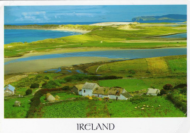
Ireland's Landscape, Ireland

Ireland is the third-largest island in Europe, and the twentieth-largest island in the world. It lies to the north-west of continental Europe and is surrounded by hundreds of islands and islets. To the east of Ireland, separated by the Irish Sea, is the island of Great Britain. Politically, the sovereign state of Ireland (described as the Republic of Ireland) covers five-sixths of the island, with Northern Ireland (part of the United Kingdom) covering the remainder in the north-east.
The first settlements in Ireland date from 8000 BC. By 200 BC Celtic migration and influence had come to dominate the island. Relatively small scale settlements of both the Vikings and Normans in the Middle Ages gave way to complete English domination by the 1600s. Protestant English rule resulted in the marginalisation of the Catholic majority, although in the north-east, Protestants were in the majority due to the Plantation of Ulster. Ireland became part of the United Kingdom of Great Britain and Ireland in 1801. A famine in the mid-1800s caused large-scale death and emigration. The Irish War of Independence ended in 1921 with the British Government proposing a truce and during which the Anglo-Irish Treaty was signed, creating the Irish Free State. This was a Dominion within the British Empire, with effective internal independence but still constitutionally linked with the British Crown. Northern Ireland, consisting of six of the 32 Irish counties which had been established as a devolved region under the 1920 Government of Ireland Act, immediately exercised its option under the treaty to retain its existing status within the United Kingdom. The Free State left the Commonwealth to become a republic in 1949. In 1973 both parts of Ireland joined the European Community. Conflict in Northern Ireland led to much unrest from the late 1960s until the 1990s, which subsided following a peace deal in 1998.
The population of the island is slightly over 6 million (2006), with 4.5 million in the Republic and an estimated almost 1.75 million in Northern Ireland.This is a significant increase from a modern historic low in the 1960s, but still much lower than the peak population of over 8 million in the early 19th century, prior to the Great Famine.
The name Ireland derives from the name of the Celtic goddess Ériu (in modern Irish, Éire) with the addition of the Germanic word land. Most other western European names for Ireland, such as Spanish Irlanda, derive from the same source.
愛爾蘭島(英語:Ireland;烏爾斯特蘇格蘭語: Airlann;愛爾蘭語:Éire)是歐洲第三大島。島上南部區域屬於愛爾蘭共和國領土。北部則是主權屬於英國的北愛爾蘭地區。
整個愛爾蘭島的人口大約為580萬人。其中居住在愛爾蘭共和國的人口有410萬人(160萬人居住在都柏林都會區),170萬人居住在北愛爾蘭地區(其中80萬人居住在貝爾法斯特都會區)。
愛爾蘭島總面積為84421平方公里,其中愛爾蘭共和國約佔70273平方公里,其餘部分為英國所轄的北愛爾蘭。愛爾蘭島西臨大西洋,東北隔北海峽與蘇格蘭相望,東臨愛爾蘭海,東南隔聖喬治海峽與威爾斯相望,南臨凱爾特海。愛爾蘭西海岸多為懸崖、丘陵等(最高點為卡朗圖厄爾山(Carrauntoohil),海拔1041米)。島內地形比較平緩,多為農田,香農河(River Shannon)為主要河流,同時也有幾個大湖泊。島中央河谷地區沼澤眾多,盛產泥煤。地形特徵 愛爾蘭的外形像馬鈴薯狀(包含北愛爾蘭),主要為丘陵地形及原野,遍佈著森林及湖泊。
愛爾蘭為溫帶海洋性氣候,受北大西洋暖流影響,冬暖夏涼。雨水非常充沛,一些地區一年有275個降水日。主要城市有位於東岸的首都都柏林、西南的科克、西岸的利默里克和高維、和東南岸的沃特福德。
References sources : wikipedia


 Postcards received from


0 comments:
Post a Comment